


Watershed Delineation - Any Study Area
- Sep 21, 2017
- 1 min read
Water is important life-source of living things and plays an essential role in economic development and augmenting growth of agricultural sector and industrial activities especially in the angle of rapidly increasing population and urbanization. Thus analysis must be carried out on a watershed basis because all these processes are taking place within individual micro-watersheds. Watershed is not simply the hydrological unit but also socio-political-ecological entity which plays crucial role in determining food, social, and economical security and provides life support services to rural people.
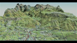
The above video provides step by step assistance to delineate watershed for any region of interest. Geographic Information System (GIS) is a computer-based tool that analyses and manages spatial data & Digital Elevation Model (DEM) can be used successfully to extract several watershed parameters. Delineation of Watershed provides lot of information like stream, slope, elevation and provides source of water for regions undertaken.
Tools and Datasets Required :
1. DEM (Digital Elevation Model) Data.
2. ArcGIS Software
Comments